Maastokartat 2.1.18
Continue to app
Free Version
Publisher Description
Maastokartat - Finnish topographic maps on your phone and tablet
Free topographic map enhances outdoor activities and aids in the exploration of new places. It enables you to effortlessly determine your location and understand your surroundings. You can save interesting places and navigate to various destinations. By subscribing to Maastokartat Plus, you gain access to valuable additional features, including high-definition topographic maps with elevation and depth details, 3D maps, property boundaries, route planning and tracking, offline maps, and location sharing.
Free features:
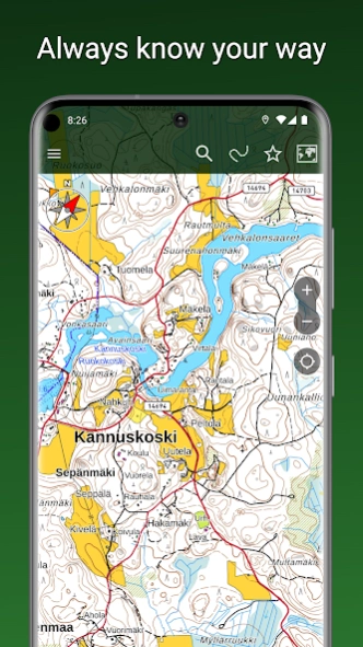
• Accurate topographic map based on data from the National Land Survey of Finland
• Aerial imagery from the National Land Survey of Finland
• Satellite images of the entire world
• Topographic maps of Sweden, Norway, Denmark, and Estonia
• Display and tracking of your location
• Coordinate display formats: WGS84, ETRS-TM35FIN, YKJ, KKJ, and MGRS
• Compass, map rotation based on direction of travel
• Navigation to a destination, displaying direction and distance
• Place name search
• Distance measurement
• Saving your own places
• Organizing places and routes into groups
• Sharing and importing places and routes as GPX files
• Backup to your personal Google Drive
• Heart rate monitoring with BLE heart rate sensors
Plus subscription additionally includes:
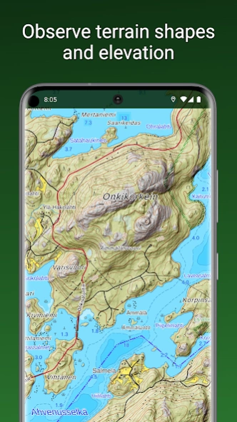
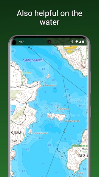
• Highly detailed topographic map with water depth information
• Hillshaded topographic map clearly showing elevation differences
• 3D aerial and satellite imagery
• Worldwide outdoor map based on OpenStreetMap data
• Offline maps, preloading maps of selected areas into device memory for offline use
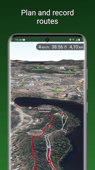
• Recording and displaying traveled routes, pre-planning of routes
• Drawing areas and measuring surface areas
• Sharing location among users, drawing another user's track on your own map
• Property boundaries and identifiers as separate map layers on top of other maps
The Plus subscription can be purchased as a one-time payment for €8.90 / 3 months or as a recurring subscription for €18.90 / year, which amounts to only €1.58 / month.
About Maastokartat
Maastokartat is a free app for Android published in the Geography list of apps, part of Education.
The company that develops Maastokartat is MapsiTech Oy. The latest version released by its developer is 2.1.18.
To install Maastokartat on your Android device, just click the green Continue To App button above to start the installation process. The app is listed on our website since 2024-03-08 and was downloaded 4 times. We have already checked if the download link is safe, however for your own protection we recommend that you scan the downloaded app with your antivirus. Your antivirus may detect the Maastokartat as malware as malware if the download link to com.swampsend.maastokartat is broken.
How to install Maastokartat on your Android device:
- Click on the Continue To App button on our website. This will redirect you to Google Play.
- Once the Maastokartat is shown in the Google Play listing of your Android device, you can start its download and installation. Tap on the Install button located below the search bar and to the right of the app icon.
- A pop-up window with the permissions required by Maastokartat will be shown. Click on Accept to continue the process.
- Maastokartat will be downloaded onto your device, displaying a progress. Once the download completes, the installation will start and you'll get a notification after the installation is finished.
